
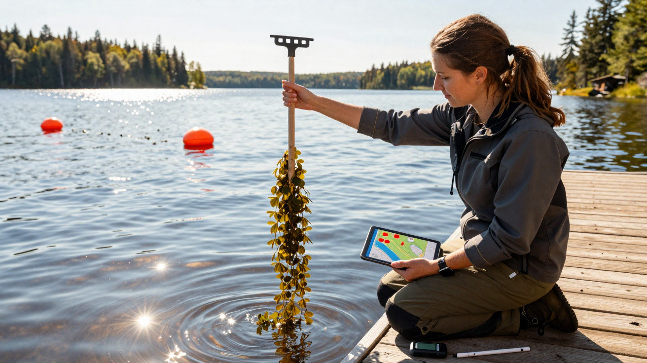
Most weeds are finished once you tear them up. This one reacts differently: every snapped-off piece can float away, anchor itself, and turn into a completely new plant.
That trait has allowed an invasive submerged weed to move through hundreds of lakes in southern Quebec.
For a long time, only low temperatures held it back. Further north, ice lingers for longer and the summer season is too brief for the plant to establish itself.
A new forecast indicates that this natural barrier is weakening, and it pinpoints which lakes are likely to be the next to face invasion.
A weed worth watching
The species is Eurasian watermilfoil (Myriophyllum spicatum). Over decades it has steadily taken over lakes and rivers, forming dense carpets just beneath the surface.
Those carpets cause the real damage: they reduce light, squeeze out native vegetation, and, as the plant decays, it strips oxygen from the water. Cutting it does not solve the issue-broken pieces simply regrow.
The research was led by Grace Fedirchuk, a biologist at the University of Quebec at Rimouski (UQAR).
Her aim was to map where the plant is already present and to work out where it could turn up next. To do that, the team set out to forecast its spread.
Warming in the north
Historically, cold conditions did the job of keeping the plant at bay. Northern lakes froze solid and remained cool into the summer, seldom reaching temperatures that would let the weed take hold.
Climate change is starting to erode that protection. As average temperatures rise, lakes that used to stay cool well into summer are heating earlier in the year and staying warm for longer. This trend is not confined to Quebec.
Elsewhere, forecasts have suggested that heat-tolerant aquatic plants will shift towards the poles as the climate warms, moving into areas that are becoming more suitable-an effect described in one paper focused on a floating weed.
Building the forecast
To project future spread, the team supplied a model with thousands of observations showing where the plant has been found and where it has not.
Each observation was paired with around two dozen local variables, including temperature and rainfall, as well as lake size and the number of people living nearby.
From this, the model identifies the conditions that favour invasion and then calculates the probability of invasion for other lakes. The researchers ran it across roughly 12,000 watershed areas throughout Quebec.
They also tested six scenarios, each combining different warming trajectories and population projections out to 2100.
A forecast of this kind is only as strong as the information underpinning it. An earlier study of the same species highlighted water temperature and human access as among the clearest indicators of where it would appear.
Local data wins
One result stood out as unexpected. The team ran three versions of the model: one using Quebec records, one spanning the North American range, and one based on the plant’s native European range.
They then assessed which approach produced the best predictions, and the Quebec-based model came out on top-by a wide margin.
Even though the continental and European datasets were much larger, the model trained solely on Quebec data was substantially more accurate. The finding underscores an important point.
When a species is pushing into new territory, it may not behave in the same way as it does in places where it has been established for decades. The model needed to learn from the invasion front.
A driving force
When the team examined which variables mattered most, one factor clearly dominated.
The strongest signals were how hot a lake becomes and how long it stays warm, with rainfall and water retention also playing major roles.
One human influence also stood out: the number of people living around a lake. Busy shorelines typically mean more docks, more boat launches, and heavier boat traffic.
That is precisely how the weed travels from one lake to another. All it takes is a broken stem.
Fragments can stick to propellers and trailers, survive an overland journey, and then root in a new lake. This aligns with an earlier model that closely linked spread to boating patterns and road access.
Mapping the spread
In the hottest scenarios, the potential area for establishment increases by almost fivefold, extending across waters in Quebec that are currently unsuitable for the plant.
The most pronounced expansion is concentrated in two regions. Western Quebec becomes markedly more vulnerable, and so does a long corridor along the St. Lawrence.
These hotspots are not accidental. They lie where rising temperatures coincide with dense human activity.
Those same two pressures-heat and people-were the leading drivers the model flagged for making a lake susceptible to invasion.
Tangible next steps
Before this research, there was no province-wide view of how Eurasian watermilfoil might move as the climate warmed.
This work provides that picture, and it is built on the key insight that local observations can outperform broader datasets when predicting a species that is still spreading.
That has practical implications for managers. Rather than responding after the weed arrives, they can use the forecast to prioritise surveillance and try to prevent establishment in the first place.
Prevention has consistently been the most cost-effective way to tackle an aquatic invader, and a more precise map helps make that feasible.
The cold that once shielded Quebec’s northern lakes is diminishing, and the forecast now shows where the weed is most likely to move next.




Comments
No comments yet. Be the first to comment!
Leave a Comment